Drone Catalogue
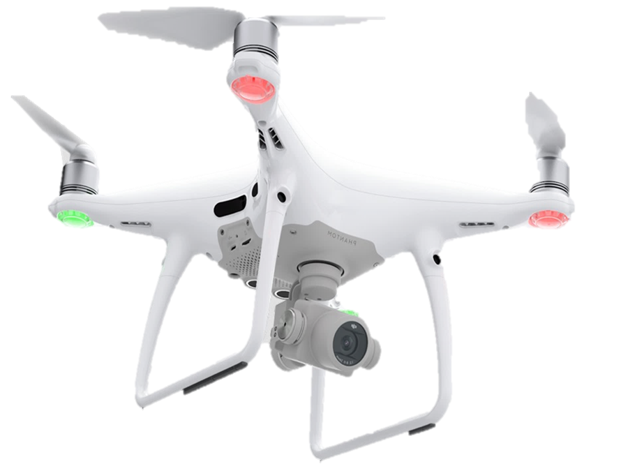
The DJI Phantom 4 PRO / PLUS / RTK
Incredibly rugged Drone suited for small area and corridor mapping. Has a battery lifespan of between 18 and 25 minutes depending on function and an ultra high resolution camera with 4k camera.
- 1cm resolution Horizontal and Vertical Accuracy for survey grade assignments.
- Suited for close range Building assessments, 3D Modelling, Rooftop mapping and short range surveillance.
- Incredibly popular and common.
- Can generate lidar point clouds for automated extraction of building footprints, power lines and trees as well as produce Digital Surface and Elevation models.
The DJI Mavic Pro
Smaller than the Phantom 4 Series and Incredibly rugged Drone suited for small area and corridor mapping. Has a battery lifespan of between 18 and 25 minutes depending on function and an ultra high resolution camera with 4k camera.
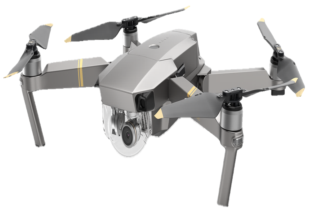
- Suited for close range Building assessments, 3D Modelling, Rooftop mapping and short range surveillance.
- Sleek flight operations.
- Very suitable for extremely small areas and tight spaces.
- Powerful Cameras x30 Zoom.
- Flight ceiling up to 150m
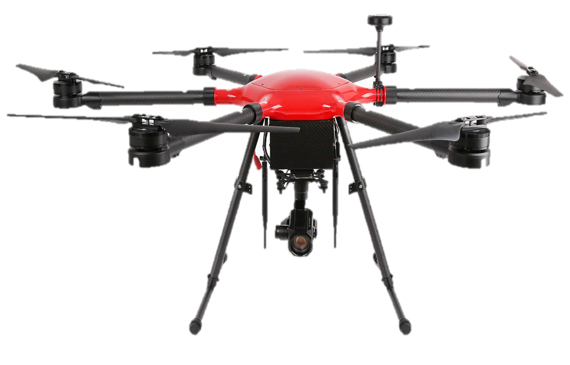
The Walkera V1100
Sporting an incredible transmission range and a long battery life of about 60 minutes, the Walkera V Series is the ultimate drone for surveillance and inspections. Suited for large area developments, Thermal mapping, Modelling, and Long range surveillance.
- The Walkera V also features a 30mp camera lens with options between Thermal and Multispectral lenses.
- Incredibly rugged Drone suited for large areas and Perimeter surveys.
- 1cm resolution Horizontal and Vertical Accuracy for survey grade assignments
The Matrice RTK Series
The Matrice 300RTK / M600 Pro is a group of elite drones with improved flight performance and better loading capacity. Pre-installed arms and antennas reduce time required for setup, and the system’s modular design makes it easy to mount additional modules. It is well suited for large area assessments, power line mapping, Real time inspection and surveillance up to 25 km.
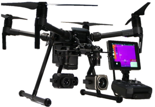
- The airframe is equipped with the latest DJI technologies, including the A3 Pro flight controller, Lightbridge 2 HD transmission system, Intelligent Batteries and Battery Management system. Several Zenmuse cameras and gimbals are natively compatible and full integration with third party software and hardware make the M600 Pro ideal for professional aerial photography and industrial applications.
- Can support up to 3 different Sensors at a time.
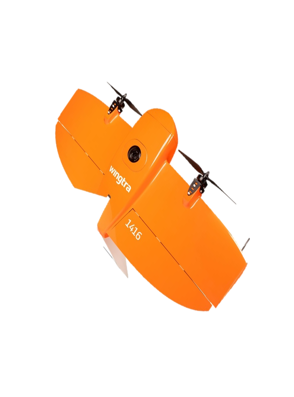
The WingtraOne
The Wingtra-One drone is a fixed-wing drone that combines vertical take off and landing (VTOL) with long range flight. WingtraOne PPK sets the new benchmark for drone survey equipment.
- It is safe and accurate.
- Can be operated everywhere (in confined spaces and rocky ground).
- Can complete large missions in less time (up to 400ha in one hour).
- Has high quality cameras that can be swapped.
- Has a flight time of 59mins.
- Thanks to its design, a professional drone PPK GNSS L1/L2 receiver and high quality mapping cameras, like the 42 MP full-frame Sony RX1RII, it is now possible to reach down to 1 cm (0.4 in) absolute accuracy with an aerial survey drone.
The DeltaQuad Pro
The DeltaQuad Pro is a VTOL fixed wing mapping drone that comes with a fully integrated mapping mount for several types of high grade camera systems. The system is outfitted with a trigger mechanism and an easy to use removable mount compatible with the selected camera. Asahi Dragontail glass is installed to protect the camera from dust or damage during takeoff and landing.
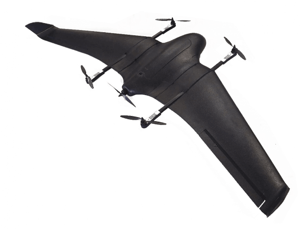
- Fully autonomous from takeoff to landing.
- Interchangeable mount for stable holding and maximum protection of the camera payload.
- Hardened glass window for protection against water, dust and damage during takeoff and landing.
- Fully autonomous mapping missions from takeoff to landing.
- No pre-flight calibrations required.
- Online mission validation & log analysis tools.
